
-
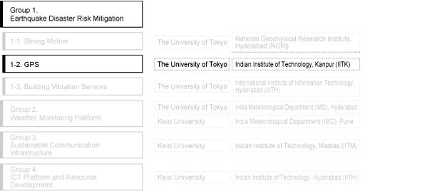
Group 1-2. Earthquake Disaster Risk Mitigation “GPS” : Outline
Research Member
Study Implementation Method / Research Implementation Method
Performs active fault mapping and slip rate estimation in the NW-Central Himalayan region. GPS data, together with high resolution satellite photos and geological data will be used to identify active fault scarps and related features. Slip rates are calculated to estimate recurrence interval along the faults in the study area.

Route map of the exploratory investigation by Japanese and Indian researchers in November, 2010